Sunday 29 November 2009

Offas Dyke, Knighton, Powys

The end of the decade approaching, its time for another walk. This time the group headed off to the welsh border, to a town called Knighton. Those who came along where some of the usual suspects, Helen E, Paul and Antony. All of us running rather later!!

We stated walking from the long term car park at SO 28892 72218, the weather was lets say not particular pretty. Not raining but the cloud was hanging low on the edge of the hills. We began walking through the town of Knighton and following directions to the Offa's Dyke Centre which is on the edge of the town. We popped into the 4219639004_0562c1747egarage stroke supermarket stroke butchers for some food and a map!! Problem was I bought the wrong map. Doh! Oh well will have to plan another walk using that map sometime.

All the way through the town, we saw some  rather odd sculptures lying in front of this building. A giant spatula for example. Interestingly odd!! We walked into the Offa's Dyke Centre to buy the correct map! We had a little nosey around the displays which detailed some of the history and the nature in the area around the dyke.4218876893_21d4bbf238

Back out of the centre we walked northwards onto the long distance path which descended down to the River Teme. The river was very close to bursting its banks. There had been a rather lot of rain recently so it was no surprise. Carefully walking  around the meander in the river we got to the railway bridge, which the footpath crosses. Making sure there were no trains we ran across to the other side!

After we crossed the road and through a small wood we began climbed up and 4154668695_70f1dfe745round a field with a few cars abandoned at the bottom! I wonder if they had driven from the top!! Looking back across the valley you could see the dyke clearly cutting down the side of the hill. At the top of the hill (quite sharp gradient), we followed the path by another wood, and followed the contour of the  hill. There were some great views along the Teme Valley, although visibility was limited! We continued along the path 4154669185_a1bd956fa9 in a north westward direction. We passed an old cottage which had better days and eventually hit the top of Cwm-sanasham Hill (406m). We started  the walk a little late so time wasn’t really on our side so we began the descent off the hill down towards Selley Hall. To be honest the weather was getting a bit iffy.

After the steep decline we got to a place called Brynorgan (a couple of houses) and decided to take the path which skirted around the bottom of Cym-sanaham Hill. Although it was a path it ce14745_193204271034_629401034_3736413_7679819_nrtainly didn’t look like one.  Not maintained at all. Scuttling through a few trees we made it across a few fields to a farm, where according to the map there is a minor road down to the river. Problem was some very angry dogs came hurtling out. They were not at all happy and made a right racket. So instead of antagonising them any further, we had little option but to climb back up the hill.

The track circled up past a few more abandoned cars, up a little valley where it joined back up with the dyke. We then retraced our route back towards Knighton. Walking past another pointless stile 19553_258741331222_597876222_4859862_4623691_n and then down the hill in the darkness, we made it back where we found a curry house :)


Details:

Persons present: 4
Start and End: SO 28892 72218
Total Ascent: 360m
Total Distance: 12km
Time: 5 hours

Sunday 25 October 2009

Cleeve Hill, Cotswolds

Off to the Cotswolds we go! Although my navigation to get to the start point was much to be desired.. First of all I went straight past the turn off, then I drove all the way up to the Golf Club only to turn back out again. Luckily Rowena, Jon (first timer) and Mikey (first timer) found their way okay and I waited at the start of the road to flag down Antony who was on his own and Jon, Marta, Paul and Helen who were in another car.IMG_5512

After trying to drive straight up the bridleway, I realised my error and turned left into the disused quarry which had been converted into a car park. Now with the whole group together we began the walk from the coordinates (SO98915  27512). We walked through the golf course which was a little odd in itself. Dodging any misplaced golf balls we walked over a cross dyke, just a bit west of the summit of Cleeve Hill (317m). A set of radio/TV masts dominated the skyline as we walked across Cleeve Common. It was quite a gray day really. Not looking like it was going to rain but equally the sun was on holiday as well. IMG_5528As we walked across the Common we saw quite a few people kite flying and what can only I guess be described as grass skiing by kite. Very interesting contraption this gent was driving!! As we got to the masts at SO 99415 24817 we followed the fence wall, across another minor top (330m) towards the car park at West Down.

We had a break whilst various members of the walking group ran off into the bushes, one at a time. No scandal here. We then marched IMG_5530 on down the road towards the village of Brockhampton, where we found a pub for some lunch. Finding an empty beer garden, we had a rest and a beer. The sun made an appearance which was pretty good timing!

After lunch we walked passed Brockhampton Park – very nice house in the country and wandered up the road past Cotehay Farm towards Charlton Abbots. At the crossroads we turned left up towards Westwood House, through a lovely little wooded valley. We heard some strange noises in the woods!! Maybe some deer or birds not sure. We climbed out of the valley and up a long reaching field to a disused barn before joining the Cotswold Way.

We cut back across the Common, the guy in what appeared another contraption still hurtling along pulled by the wind!! We headed north west to the top of Cleeve Hill (317m), IMG_5538 where we sat to admire the view. After negotiating the golf course we made it back to the car with lovely views back across towards Cheltenham and the Black mountains far in the distance.

Details

Attendees: 10
Start and End Point: SO98915  27512
Total Distance: 17.2km
Total Ascent: 205m 
Time: 5hr

Sunday 4 October 2009

Melbreak and Grasmoor, Lake District

Not many takers for this one. But considering the time of year, Summer long gone and a weekend of rain and windy weather in Lakeland it was no surprise. Nevertheless Paul, Helen E and I travelled up to the Lake District late after work on the 2nd October. We headed towards Loweswater which is a few miles south of Cockermouth to some budget hostel accommodation, or as it turned out old Swallow Barn (Map Ref NY115 227). Can’t really complain it was only £7 for the night. IMG_5381

As we got there at the dead of night, we didn’t really see the surroundings very well. The owner told us where things were and left us to ourselves. We had a beer and called it a night..

The weather was a tad shocking in the early morning. I was quite glad there were no leaks in the barn. To be honest it was very basic (reminded me of some places I stayed when I was in SE Asia) but it did the job. We rustled up some breakfast and took our time. The rain died down thankfully IMG_5382 so we donned on the boots and started walking. Helen expressing little desire for any exposed ridge walking as it was too windy – more on that later.

We started walking southwards across a few fields and passed a farm and then entered a wood on the south shoreline of Loweswater. The ground was a little soggy but at least the sun had broken through now. The lake visible through gaps in the trees.

Exiting Holme Wood we crossed some fields where we spotted a few birds of prey flying above as we walked along the drive to the farm, dodging the speedy post van! After a mileIMG_5409 or so we got to the village of Loweswater and our closest pub, slightly further than one would want for a local! It looked quite nice so we decided we might stroll back in later.

We headed out towards the Brackenthwaite Hows and on through the Lanthwaite Woods. Then from nowhere a red squirrel dashed in front of us onto some cut logs by the path. Trying to get the camera, I could only get blurred shots!! Then after no time at all the squirrel was up in the trees and out of view!! IMG_5420 Moving on, we arrived at the top of Crummock Water, where the was a well placed bench in a parting of the trees, so we decided to have some lunch. The views across the water were lovely, with the high hill of Grasmoor dominating the left side and Melbreak on the right. Both wanting to be climbed! The weather was behaving itself now, although still a little bit blustery we walked around the top of the water past the pump house and up through some fields up into Green/Flas Wood (NY 146 201). Still debating whether or not to climb up a hill we decided to go for it, we walked around the north side of Melbreak. IMG_5432

It was quite an exposed route up (oops), past Raven and White Crag. At some points extremely windy but there were clear views back over Loweswater and beyond. I strolled ahead and waited at the top by the cairn of stones (509m). Helen, Paul and I trying to stay up, without being blown over by the wind!! Time passing we knew that the sunlight hours were falling away so we descended quickly down into Mosedale (Moseley in the IMG_5452Lakes???). A lonely clump of trees in the middle of the valley caught my eye, as the shadows started to get long. We then went full cycle and headed northwards past an Earthworks and back to the pub at Loweswater. After a pint or two and some food we walked back  along the main road, in complete darkness, a good place for ghost and horror stories!! After a few miles we got back to the hotel! ala barn and rustled up a few bottles IMG_5462and called it a day.

Woke up, the sound of wind gone, and the sun was out. Excellent. Now I needed to persuade my companions to climb up a large hill before we head off home. After some breakfast, we packed up and decided to head over towards Grasmoor. We began the walk at the car park at Lanthwaite Green Farm, crossed the road and headed towards Gasdale Gill. There were quite a few people out walking today but they walked off towards Whin-Ben which was towering over us on the left. We walked along the beck, scrambling at points. The stream was throwing water down so at some points it was a little tricky.

The path easing out and the full stretch of the Gill came into view. Negotiating some waterfalls the walk climbed up towards the col, IMG_5478 called Coledale Hause. At this point you could see all the way down to Braithwate and Keswick, with the large hills of Skiddaw behind. At this point Paul and Helen wanted to make tracks back, so I decided to carry on and join them back to the car, so our stories diverge at this point. Determined to get to the top, I headed southwards with Crag Hill towering to my left, I cut up a steep slope up to to Grasmoor. The actual summit was a bit further on than what I thought! At a height of 852m the hillIMG_5497 gives a great panoramic view of the western lake district. I managed to pick out Great Gable and Pillar in the distance!! Also hanging in the air were a couple of Para gliders. They must have had an awesome view. Conscious of the time I began my descent down Lad Howes. This ridge swept down towards Crummuck Water below. 

Watching one of the Para gliders crash into some bracken – that IMG_5503 must have hurt – and then take off again.. the path opened up onto the road which I followed back for a mile or so back up to the car park. Glad to see Paul and Helen waiting we began the long journey back home.

Details

Loweswater and Melbreak
Total Ascent: 580m
Total Distance: 15.5 Km
Start and End: NY115 227
Time: 6 hours.

Grasmoor and Gasdale Gil
Total Ascent: 776m
Total Distance: 9.95km
Start and End: NY159 207
Time: 4-5 hours

Monday 21 September 2009

Ironbridge and the Wreakin, Shropshire

For once we decided to walk closer to home!! This time we all met at Ironbridge down in the gorge. Although we still managed to get confused with the car parks oops!! Helen P and myself were joined by Antony, Rachel (first timer), Helen E, Marta and Jon.

After donning on the boots we walked over the bridge (famous one :) where we encountered the local rotary club trying to make a 10p chain across the bridge! I helped them with a couple of centimetres and then sunk the rest my spare change into a lovely pie from the shop.

3988042992_41ff577bb2

It was quite a pleasant day not particularly sunny but not gray and cloudy either. We began by following the Severn Way and strolled past the heritage museums. I still think its bizarre that the English put a power station right by a world heritage site! Trying to not be overshadowed by the cooling towers and ignoring the hum from the wires and generators. I looked back at the idyllic scene. We even managed to go off road.. and get lost in a load of stingers! Not the best..

We walked by the river and passing an amusing sign we passed through the small village of Buildwas.3987302963_206b50499b We then cut north across the fields avoiding a few cow pats! After checking the map for the path we were made tracks to catch up with the Shropshire Way. Heading west with the Wreakin in grasp we arrived at the south western edge!! and the climb began!!

I was actually surprised how steep it was as we walked up through the woodland. We came to the top of a little hill – and as it says on the map it’s the Little Hill! With sun out now as well.. it felt like the middle of summer!!

Stopping for some lunch, I remarked that this wasn’t the top and there was more of the hill around the corner!! Continuing up through 3987334241_6087e1abebthe woods we went past the Needles Eye.. up onto the rocks with quite an impressive view of the Shropshire countryside. It was  a little bit hazy but you could still pick out the Malverns in one direction.

We then went on to walk down from the Wreakin through Heaven and Hell gates and we then stopped at the Wreakin cottage for a well deserved cup of tea :) and a couple of ice creams. After mid-afternoon refreshments, we continued on through the wooded area/fields and up onto a minor road that took us to Little Wenlock.

A short hop down Coalbrookedale road, I mastered the art of making a stupidly loud noise 3988099958_13771f7c40with some grass and my hands. Feeling very proud of that achievement we went over  the dual carriageway and down on to the Rope walk towards the heritage museums. Passing the old Victorian Ironworks we made our way through the village back over the bridge and back to the cars.

Details:

Start and finish location: Car park by the Pub in Ironbridge (SJ6750 0350)
Distance: 20km
Altitude Gain: 604m
Time: 7hr (including stops) 
Walk: River and Woodland Walk.
Group Size: 7

Saturday 8 August 2009

Snowdon Horseshoe, Snowdonia

The summer is in full swing, and a free weekend, of course its off to Wales again. Third weekend in a row for me! With a few of the group, others either busy or too scared – only joking! we decided to attempt the horseshoe!! Driving up on a Friday night we made way to Mountain Farm Campsite in Llanberis, which was remarkably easy to find, once you found the right street in the middle of the little town!

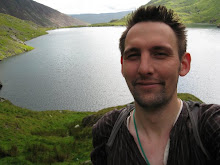
On entering the place, it was like a mini festival! Lots of campfires going and people drinking beer. Met the owner briefly who was friendly and chatty. I moved on to put up my tent. Considering the campsite is on a slope, it was difficult to find a relatively flat horizontal space! The neighbours seem chirpy enough and their van was comical.IMG_4534 Looking from my tent with a nice cool beer as the sun setted, the Kendricks gave me an update that they would be another hour.. lol and my head torch was nowhere to be seen… so i could only drink and not read – tragedy.

  Phil, our other companion was doing some last minute packing for his latest venture abroad, so he decided to join us the next day.. So at about 11pm, the Kendricks turned up and after quickly sorting there tents we had a beer and reminisced old walks and times.

On waking up, the sky looked clear with a few hazy misty clouds above the horseshoe.. the weather looked good. I rustled up some tea and some breakfast. Phil kept his promise and showed up just after 8amIMG_4531 . The tents packed up and ready to go, only one thing left to do. Get the cars out of the field. Didn’t really think about this the night before. My expert front wheel rust bucket would surely be able to make it!! No chance.. Luckily a few lads sporting Everton FC shirts, from the surrounding tents came out and pushed the car up and out of the field. I decided to avoid telling them I was a Liverpool fan. Rich’s car next – his clutch burning in third we decided to help him too :)

Once on the road, we headed up the Llanberis pass towards the Pen-y-Pass car park, on the off chance there might be some spaces. In vain unfortunately. There were a lot of cars, and the token twat who tried to kill us all on one bend.. so we made it back down to the Nant park and ride. IMG_4535 I thought park and rides were for supermarkets?? Downing a few fizzy drinks we got on the open top bus and made the way back up to the car park where we started the walk (SH64735 55617). As expected the area was crowded as is often the case. Snowdon unfortunately is a tourist mountain and therefore many people attempt to climb this hill that are complete ill prepared. There were plenty of cases around that fit that bill.

For those of you who don’t know, the classic horseshoe route is about 12km long and begins and ends at the Pen-y-Pass car park. The route takes in all five peaks of the horseshoe. Typically in the anti-clockwise order of Crib Goch, Garnedd Ugain, Yr Wyddfa (Snowdon), and the twin peaks of Y Lliwedd. The distance is not very far but some parts of the route are grade 1 scrambling! More on that later. The last time I did the horseshoe, I went the other way! For the kendricks it was their first time attempting the horseshoe.

We began walking along the Pyg Track, which since the last time I had been to Snowdon has had a bit of a makeover. Looks like a lot of rock has been airlifted in. I guess to cope with the sheer numbers of people. We made relatively good progress up towards the break in the path for the route up to the ridge (SH63335 55272). We took a breather and looked southwards over the deep blue lake called Llyn Llydaw. We then continued on up through Bywlch y Moch, with the looming Crib Goch above us. IMG_4538 The weather unfortunately became overcast and some cloud had now appeared on the tops which was a shame, but that didn’t prevent us from good humour as we took another breather..

The number of people had dropped from literally hundreds (on the Pyg Track) to tens of people now as we reached the base of the steep climb up the eastern ridge of Crib Goch. Phil’s stomach unfortunately turned for the worst and he had a look round to see if he could find a suitable place to relieve himself. We played a little trick on him as he left his bag with us! We carried on further and Phil decided to call it a day as he was feeling even more rough than before. He took the right decision and began walking back down the hill. It was a shame but he would not have enjoyed the main ridge, whilst feeling queasy. Of course we didn’t leave the rock in his bag!!

So as one of the party began walking back down, the Kendricks and I attacked the east ridge and made good progress, although I lost them at one point! This was proper scrambling. One reason why I really like Crib Goch! We got to the top of our first peak in about 1h30m. Crib Goch at just over 3000ft (932m), although this IMG_4545 day it was misty which was a shame. The mist did come in spurts and bouts so we did get glimpses of the spectacular north ridge (that's for me next time). Having a quick snack we headed westward along the main ridge.

At several points along here you literally can have one leg on one side of the ridge and the other, on the other – don’t look down if you are scared of heights. This is by far my favourite part. Its always interesting to see how different people approach the ridge. Some people seem to crouch down so close to the rock they are literally hugging it. Whilst others seem to walk along it like a footpath! Taking in the views around as we waited. Yep you guessed it there was a queue here. Sooner or later there will be an accident up here where some people who are inpatient behind some less experienced walkers will take a tumble.. IMG_4558 We spent about an hour or so on the main ridge, mainly because of the queues, it is possible to get along here a lot quicker but that is at the crack of dawn or last thing at night!

Getting to the end of the ridge, we began climbing down to the col between Crib Goch and Garnedd Ugain. I always forget that it is quite a climb from here up to the next peak, with some great scrambling bits too :) We stopped to refuel first!! and out of the mist we could see what needed to be done. Rich didn’t quite believe there was a route!! After another hour we made it to the peak no.2, Garnedd Ugain (1065m SH61083 55167). This is the fourth time I’ve visited this trig point, every time in cloud. Maybe next time!! We didn’t stay IMG_4571 here for long!! As it was quite nippy! We then began the small descent down to where the path rejoins the Pyg Track and then a few meters further on the Llanberis path which follows the train up. Both these paths heavily congested with people, many with just t-shirts and shorts, or jeans, and in adequate footwear. Now they were paying the price. The weather up on the top of Snowdon, was pretty miserable. Snowdon itself is quite exposed at 1085m and today visibility wasn’t the best.

To compensate we thought we would have a look at the new Snowdon Mountain Cafe. From the outside its quite an impressive building and hugs around the summit quite nicely. It reminded me of the huts I have seen in the Pyrenees a few years before. We worked our way through the doors. Blimey I have never seen so many people in one place. There were several hundred people there, I kid you not. I needed the loo, so I went in! They had Dyson air dryers!! Blimey this place was like a nightclub! All it needed was a band and it would be complete. I think the people who run the place were a tad overwhelmed with the sheer number of people there.

Exiting the place sharply, we were hungry so we began the descent down, first westwards and then at a point marked by a large IMG_4578 stick like rock (SH60910 54255), we caught up with the top of the Watkin Path.  We made quick progress down the path and stopped for some lunch under some of the rocks. The weather had improved at this point. Whilst we were eating our lunch entertainment was provided by first a completely in appropriately dressed walker. She had smart black shoes, jeans and a nice top – and a black hand bag – obviously taking hiking fashion to a new level. She made a wise decision and turned around and walked back down from where she came. Shortly after that we saw a Beatles tribute band with guitars making strolling past. Couldn’t really quite believe it. I guess they were going up to the highest nightclub in Wales..

IMG_4575After feeding a seagull with some nuts, we reached the col between Snowdon and Y Lliwedd. The Watkin Path continues downwards (in SW direction at SH 61935 53697). Our route was not downwards but upwards :) Two peaks remained the west and east peaks of Y Lliwedd. After the traffic jams of the approach routes to Snowdon, this path was empty bar a couple of climbers at the top. We made it to the West Peak just as it cleared up, briefly! The gap in the cloud gave us a brief look over towards the Crib Goch main ridge we did earlier. After passing the twin peaks at 898 and 893m we began our descent down towards Llyn Llydaw and IMG_4580 onto the miners track and made time to make one last video before we said goodbye to the horseshoe.

We managed to get back to the car park at around 4.30pm and did not wait long for the bus to get us back to the car.

Details:

Start and finish location: Pen-y-Pass car park (SH64735 55617)
Distance: 12km
Altitude Gain: 1012m
Time: 7hr (including stops) 
Walk: Hill and Ridge Walking, Scrambling Grade 1 in places. 
Group Size: 4

Last Comments:

If you want to visit Snowdon, I recommend you go either very early in the morning or late on in the afternoon on a clear day, thus avoiding the bulk of the crowds. The quietest route up is via Y Lliwedd, which is great!! Crib Goch should only ever be attempted with the correct walking/climbing equipment.

Sunday 19 July 2009

Comb’s Edge, Peak District

Up early on a Sunday morning, some up earlier than others, we all made our way to the Peak District National Park, and in particular to just off from the Goyt Valley, near the car parks there. Unfortunately many of us running late, some of the walkers thought hey had been left stranded.. :) Anyway as the time approached 11am, we all began to turn up. Walking today were, Helen P, Fran, Scott, Paul, Helen E, Marta, Jon, Antony, Rowena, Laura, Kiri, and their friend Tom (newcomer) and myself. A few sickies and alternative plans came in from a few others. IMG_4460

The walk did not begin with the best of starts as we were trying to get everyone in the same place, once done, we avoided the initial stroll up Goyt’s Lane, which I’m sure I wouldn’t be popular if I made people walk up that first! We began walking for proper, at the car park at the top of this road (SK02043 75178) and headed eastwards back to the main road from Buxton to Manchester (A5006). We passed a shrine on the left. Omens? At the junction we went through the gate and walked down the track towards Rake End. As we approached the road, the clouds started to empty, not for the first time. So the usual stop and donning on waterproofs we got back onto the main road where we walked a couple of hundred yards and went other a stile and headed up the hill (SK02400 76288). IMG_4457

This winded eastwards around a contour in the hill through a rather muddy track towards the Whitehall Centre (Outward Bounds). Plodding through the half foot deep muddy water, we spotted that the centre has their own little go ape in the trees! We carried on and walked around the back of the centre and onto the Midshires Way. After initially missing the turn point at (SK03338 76360), I managed to gather the group back and we began crossing the hill towards Broadlee Farm.

After crossing a few fences and fields, I managed to find a minor footpath which would take us up onto the hill. Although to be honest it really didn’t look like much of a path at all. To which I had to convince most of the walkers that it was actually a path and not just some random off road route (SK03560 76598). We walked over through some rocks, and hugged the side of the hill which is the start of Comb’s Edge. Although sidetracked by some interesting looking gullies, we preserved through what looked like Jurassic Park.IMG_4462 Some of the ferns were as tall as me! Luckily the weather had behaved itself at this point. But I still got soaked from all the water in the undergrowth.

We could see our destination for lunch, which was a small old croft sitting on the side of the hill (SK05155 76808). Admiring the views across to the village of Combs and the reservoir beyond it we could see quite a lot people out sailing. As we cleared up and moved away it was clear that the rain wasn’t going to hold away for much longer. We kept up on the edge of the hill by the wall. You could just about hear the rain hitting the trees in the valley a mile or so away. A rainbow became clear in the valley, as we turned north eastward at the old Iron Age fort, long ago reduced to a mound in the hill by the ravages of time.

As we turned it became even more obvious that we were not going to escape the rain. A huge and rather angry gray cloud was suffocating the horizon. We carried IMG_4473 along with a bit more pace along Shorts Edge and then up to Hobs Tor (507m). By this point we were walking in the midst of heavy rain. All of us soaked we continued on as quick as we could in the direction of Buxton, along Blacks Edge (SK01365 76700). A radio mast came out of the mist and rain was the first indication I managed to get it right at this point, we walked around a small brook and then over a rather precarious stile and began the descent down from Flint Clough (SK 05320 75448) towards the Lightwood Reservoirs.

It had to be said there wasn’t much water in the reservoir more really on our clothes as we walked around the empty hole in the ground! We strolled through the woods and down towards the edge of Buxton. IMG_4475 At this point the rain had stopped thank goodness, but half the group had steamed on ahead. Finally managing to see where they were and trying a few phones with no answer, someone popped their had back around and realised they had gone too far down the road.

With the group reassembled we walked passed the Park at the Hospital back onto the Manchester road. Walking for a mile or so it became clear to me that the weather made the road quite dangerous, so I decided to walk the group up the Midshire’s Way (an old roman road). A bit tired and weary it became clear I had made mistake in thinking there was a footpath further up across the fields to the top of Goyt Lane. Near quite an appropriate named place ‘Round the Bend’, half the group chose to make a dash across the fields as they realised the road was nearer at that point. The rest of us plodded on a mile or so down the track and caught back across. Only later did I find out that one of the party knew the area well and walked their dogs regularly cross the fields.. so some of us walked on further than we had to.. One of the party injured as well, this was not the best.

A breakdown in communication was thankfully not made worse, to the efforts of a few people guaranteeing everyone was alright. We all made it back to the car IMG_4482 park pretty much at the same time and in one piece. A few of the party rushed of to prior engagements, some of the remaining of us headed back to Buxton for a much deserved curry. A nice lamb Shashlik yum! Although I think Jon and Marta were trying to avoid the fourth day of curry in a row :)


Thanks to everyone who came along. I hope you  all enjoyed the walk apart from the weather and the mix up at the end. Please I am only human and if people know an area where I have setup a walk, can they tell me because that kind of feedback is invaluable and helps especially when tiredness sets in. Also please come along next time and invite some people you know who want to stretch their legs!!

Details:

Start and finish location: Car park at top of Goyt Lane (SK02043 75178)
Distance: 21km (shorter by around 2km in you cut across the fields)
Altitude Gain: 446m
Time: 6hr
Walk: Is through undulating hills, fields, woods and moorland.
Group Size: 13

Sunday 21 June 2009

Tryfan and the Glyders, Snowdonia

Been quite some time since the last lets go for a stroll outing, so it was time to organise another and hope we get a little bit of sunshine for the weekend. The met office forecasts were in our favour and even the drive up on the Friday night, gave good promise of a decent weekend walking was ahead.  Managing to leave work early and being chauffeured part way there we got to the campsite in good time. Antony was just in front of us but unfortunately he stopped at the first campsite he came to past Capel Curig, which was the wrong one :) To be fair there is only one differentIMG_4283 word in the name and they are a mile apart. He wasn’t the first or the last, after meeting Gillian there. Luckily my phone had reception and I managed to contact them and they made their way other to Gwern Gof Uchaf campsite.

First time I’ve stayed at this campsite, the owners see pretty friendly and despite the weather getting a bit blustery it was filling up fast with climbers, walkers and canoeists alike. My siblings, Luke and Alice had given me their tents the week before and I was supposed to get them up before they arrived, however they made great time driving up from the south coast and they in the end helped me put their tents up – how does that work! Next to arrive was the Macclesfield posse of Phil, Paul (new member), Rowena, Laura and Kiri (new member). Phil delighted us with his new pop-up tent, which campDavidliterally did pop up! Although the design of the pattern on the outside was a tad suspect and had more camp than david in it. And so on to the Camp David signs, to which Laura, Rowena and Kiris effort completely blew away all competition as they draped the banner over their tent!

Next to arrive was Paul and Helen and then finally the party was complete when Rich turned up. Explaining that he had already pitched his tent in the wrong campsite because it was dark. oops. So he ran off and came back with the tent! A  few beers and some comedy from Brown, the night set in and although the campsite was very busy earlier, it became very quiet all of a sudden, except for meUpToTryfan us noisy bunch! Then pretty much out of the blue, it absolutely lashed down. It had been windy or evening, but now the rain had come in and we all sloped back into our tents and caught some kip.

With most of our tents shaking through the night with the wind and rain, few of us managed to get much sleep. Antony and Gillian sneaked off to obtain some morning luxury with a coffee and a bacon sandwich, much to Rich’s dismay. I was being camp chef and rustling some sausages sandwiches and tea in the rain. Eventually we all manage to get our stuff together, waterproofs IMG_4305and all, and began walking about 11am. Not an early start but to be honest it wouldn’t have been that much fun in the rain.

We started by heading up past the farm cottage northwards and walked up along the Nant Gwern y Gof. The ground was absolutely sodden with water, and my now rather worn boots were not doing much to keep my feet dry. We plodded on southwards across another stile and up through some more rocky ground. Eventually the contours started to increase and the cloud was coming in. Tryfan was mostly obscured by cloud at this moment, and frequent bouts of rain were falling on us. Considering the mountain forecast from the met office was sunny, I was hoping at some point during the day we may get some sunshine.

We clambered up a scree slope and had a rest and turned direction towards Tryfan, so thats north westward now, we followed the path round the hill. As we were climbing up to Bwlch Tryfan, Helen P spotted something on the ground. It IMG_4284was a perfectly frozen dragonfly, poor blighter probably flittered up there and got caught out by the cold night. Once on Bwlch Tryfan, the first split off the group occurred. Antony, Gillian and Helen P decided they wanted to go back down to the campsite. The rest of us had one thing in mind, to try and get to the top of Tryfan!! So we continued on. Over the wall we turned north and followed the path around the west side of the far south peak and started the scramble up. We were certainly in the cloud now.

I was astonished with how many people were there trying to climb the mountain. I suspect its close proximity to the road and that its fairly steep is  probably the reason. So getting caught in a few traffic jams going up the last 100m or so, and so rather dicey moments (well done to Paul who doesn’t like heights!) we all tryfan2 managed to make it safely to the top. Then quite to my astonishment a father was up there with his lad, and encouraged him to jump from Adam to Eve, the two iconic rocks at the top of Tryfan (915m). People are encouraged to jump from one to the other and are said to be given the freedom of tryfan. But with the conditions the way they were I was surprised that the kid attempted it – but he did and fair play, although I think parental judgement might have been lacking. So I was outdone by a seven year old this day. But I thought my boots with no grip would  not do me very well if I attempted it.

As more people clambered to the top, we all decided enough was enough, so we  walked down, passing a poor whimpering dog, who I thought his owner was being a tad cruel as it was clear the dog was unhappy – bad man! We descended down stupidFacesthe same route to the col, Bwlch Tryfan. It had now become decision time, who wanted to continue up another hill and who wanted to head back. Climbing Tryfan in those conditions is pretty good on its own, but Rich, Rowena, Laura and Kiri wanted more punishment and decided to join me to ascend up the steep scress to the Glyders whilst the others decided to make there way down off the hills.

It was quite a steep climb up the screes (near Bristly Ridge), the sky had cleared for a while and the peaks of Tryfan behind were a lovely sight. As we passed some clumsy people causing mini avalanches we got to the top of the slope and took a breather. The view waIMG_4327 s amazing, with the swirling breaking cloud. After some snacks we continued on towards Glyder Fach (994m). Just before we clambered up the the rocky top, I spotted the Cantilever Stone which I had to get a picture – hoping it wouldn’t budge with my bulk. We then claimed our second mountain of the day, trying not to slip up over the rocks.

The weather turning quite cold now and windy, a dutch/german fell runner ran passed and then like us got confused to where the path had gone. So we made our own way around the mini peak of  Castell y Gwynt (972m). We continued eastwards into the cloud. The wind became quite deafening but I managed to utter at least ten times we nearly there just around the corner! And there it was the last peak of the day. I call all the surrounding rock formations dinosaurs or hedgehogs – cause they are quite IMG_4330 spikey!! We got to the top of Glyder Fawr (999m) and then moved on pretty quickly and headed north westward down the path towards Devil’s Kitchen.

Passing the reeds in Llyn y Cwn we turned northwards and began the descent of the giant rock staircase. Although it was still quite misty, it didn’t take away the true atmosphere of the surrounding rock faces and waterfalls. We followed the path to the east of Llyn Ldwal and then on down to the Youth Hostel. I was hoping the little shop would be open for a cup of tea but no such luck! I would have to wait to the camp site! With the knees and legs tired, the walking on tarmac was relief, although the cars were not!  We carried on around Llyn Ogwen and passed the Milestone Buttress (a famous climbing haunt) and back to the campsite where we caught up with the others.IMG_4333

Back at the campsite, we all got into warm and dry clothes and all took off down to Betws-y-Coed for some dinner. Dinner options limited at the best of times in this place, I was thinking it would only be fish and chips for tea. But we managed to get a couple of tables at this one place. It was quite nice, and the starters were pretty amazing. I never know with starters if its just that I’m hungry and any decent food tastes wonderful or if it was just good!! Unfortunately the steak was not up to the same standard, and really a pale imitation of what it should have been. Well fed we headed off to a pub for a few beers. With most of us quite tired from the walking we sat around and nattered for a bit and then decided it was time to head back. Picking up a few IMG_4338 stragglers on the way we got back and got some well deserved rest.

Up early the next morning, the group started to disband. Although it did take all of us to have a go at sorting out Phil’s pop-up tent back into its bag. A combination of Rich and Laura sorted that out and as a consequence Phil still has a tent, which might have otherwise been launched or burnt!! A quick thank you for everyone for coming along it was great fun despite the weather. Hopefully soon I’ll pick a weekend which is sunny!!

Prizes

Walking with injuries but looking good in a hat goes to Ant
Scrambling over his fear prize goes to Paul.
Best Camp David sign goes to Rowena, Laura and Kiri.
Done a runner, Gillian
Booby prize goes to the met office who completely screwed up their forecasts.