Sunday, 21 February 2010

Bannau Sir Gaer, Brecon Beacons

I visited this part of the Brecon Beacons a year or two ago with two friends of mine, and always wanted to go back! So a little selfishly I organised a lets go for a stroll walk there! Last time I went the weather was pretty miserable so was hoping for maybe an improvement! To be honest most of the times I have been in the Brecons it has rained, which is a shame as it is lovely place to go IMG_5585 walking and appreciate the hills!

However mother nature decided differently and the reports from the Met Office said that there was a lot of snow that had fallen the night before, although there was a ray of hope that the sun will appear later in the day. So on that glimmer we got in the car and began the drive. Then unfortunately put off by the weather, several members of the group pulled out. It was a shame really as I knew what the place was like where we were going, and if the sun was going to come out they would miss a real treat, and indeed that they did.

Helen P and I decided that we would keep IMG_5605going as some new members had shown interest in the walk so we had to turn up!! As we drew nearer to the Brecon Beacons the weather improved considerably with a clear blue sky and the sun glistening off the snow! The roads were a little bit comical as we arrived at the start point, Blaenau Car Park (SN79917 238719). To which point the two yet unknown members of the group seemed to carry on the track past  the car park!! :) Anyway after IMG_5642verifying who I was, Dave (new member) and Gary (new member) introduced themselves! After putting on the boots and wrapping up warm we began walking up towards a reservoir which legend has it is the location of the “Lady of the Lake”.

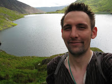
The snow was dazzling everywhere even at the lower levels where we were at the start it was a several inches deep and perfect for snowballs and snowman :) Which Helen P did decide to make when we stopped for a breather. Although it looked more like a snow monkey! We made it up to the lake which had a small refuge. Someone had even left a shirt there too. Crazies! After looking across the lake we noticed and admired some fell runners who ran passed and up onto the top of Bannau Sir Gaer in what seemed minutes. Fair play! IMG_5655 We decided to follow the same route so just in case the weather did turn, we would get the best views before it was too late.

We head due westwards up the gradient which is part of the lower Beacon Way, which joined the main Beacon path at  SN797 220. We then followed the ridge up to the beautiful ridge walk of Bannau Sir Gaer. There were large snow overhangs here so we walked as close as we could without it being dangerous!! The light on the lake was IMG_5666 refracting showing different colours of grey, white and blue. We followed the edge for a bit and stopped at the first top at Picws Du where we stopped and took the whole surroundings in! It was starting to get very cold at this point so we decided to push on. We walked across what looked like an arctic wilderness. We plummeted straight down into a col trying to not to slide down in the snow!! After losing my leg a few times in the drifts we began walking up the other side towards IMG_5678 the second top. As it flattened out near the top, there were beautiful if crafted by artist patterns in the snow formed by the wind. We carried on through to the highest point of the ridge and the trig point at Twr y Fan Foel (802m). Got to love the welsh language, had a go at pronouncing it but was very poor!!

The visibility was excellent and you could see probably Cadir Idris in the north and certainly the border hills with England. A fantastic view IMG_5690 of the main Brecon ramparts rolling off into the distance. We began the descent down and decided we would have lunch down on the opposite side of Llyn y Fan Fawr which was still bathed in sunlight.

Plodding down we managed to find the path down at Bwlch Giedd towards the lake, where we met a few others out for the day. Trying not to resist, but failing, I went for a wander on the frozen lake, hearing the cracks of the ice beneath. Not pushing it we decided to walk around to the little hill by the lake and had some lunch. Gary pretty much had a gourmet dinner with him. Top marks for preparation I tell you! Realising we only had about IMG_5694 an hour or so light left and hoping for an amazing sunset we kept on back to the other lake.

The path skirted around the base of the ridge, at best I had to check the map several times and take bearings as the path could not be seen under a foot or so of snow and there were few if any other footprints for a guide. Then we picked up a little bit of altitude as we circled around Cefn Bryn y Fuwch, as we passed the beginning of the base of Bannau Sir Gaer we were presented with an awesome sunset over the ridge. Amazing.

IMG_5714 We crossed over a few water channels and caught back up with the trail back down to the cars, passed the filter beds. It was getting dark now so the walk could not be better timed!!

Details:

Start and End: SN79917 238719
Distance: 14km
Total Altitude Climbed: 851m
Number of People: 4
Time: 7 hours

Sunday, 31 January 2010

Chee and Wye Dale, Peak District

What a cold winter we’ve been having and this weekend was no different. With a couple of inches falling in and around Macclesfield the originally planned walk to Dane Valley was a no go and it prevented a few of the walkers coming along too. Coming over the hills from Leek to Buxton, the weather looked quite interesting.. IMG_5546 Very windy, whiteout, skiddy roads etc. Then if by magic as we dropped down into Buxton, the weather was actually better (not hard comparing to what we just drove through!).

Managing to contact everyone else who was coming we managed to meet up in the Pavilion Gardens car park we decided to drive out eastward away from the scary clouds and stay relatively low off the higher hills. We drove down the A6, down towards Wye Dale and pulled up at the car park at SK10388 72519.

So on went the boots, and the group (who today where Helen P, Helen E, Paul, Jon, Marta and Edd) began walking by the River Wye on a gravel track.  The track was criss-crossed by the old IMG_5552 railway viaducts above, where some scarily long icicles were hanging. Did stand under there for too long!! We turned off the track just before the weir, by which the path took us up onto the Monsal Trail.

We walked along the old railway line for a couple of miles, joking about with the icicles. Myself doing a quality impression of a walrus!! The weather was improving now, even the sun was out!! We entered one of the long tunnels. We lost both Helens at one end, they were to busy taking photos. At the other end of the tunnel, we came out into the valley and straight onto another bridge, where the railway went off behind closed doors. I’m reliably informed that the rest of the tunnels are eventually going to IMG_5556be made safe so that people can walk through them! But then they would miss the next bit!!

After the bridge at SK12545 73109, we turned right and then walked  back under the railway bridge and then over a wooden foot bridge a yards further on. The path then gave way to a series of stepping stones which were great fun, as we turned the corner, with Chee Tor to the right, there were huge sets of icicles on the craggy rock up above. Some even started to creek and fall. Eek watch out! Of the fallen ice some had refrozen around the trees IMG_5560and plants closer to the ground. Which were very pretty. After a while and a few more crashes of ice we moved on quickly :) The trail then follows the meander in the river, we climbed up a little slope and had some lunch at the top to take in a good view of the gorge.

With Daisy and a few of the walkers getting restless we  carried on the path. It swung eastwards, and opened up into a grassy field, where a couple of weirs were placed across the river. We crossed over the bridge at SK12783 73472. Edd walked off ahead guided by his new OS Maps for IPhone app which seemed to be quite good IMG_5566tool! Although we did make a bit of a meal of the path going up the hill to an old abandoned settlement at the top. Crossing few a couple of fields we reached Blackmore Hall, where we went wrong with the path again, definitely my fault this time! All ended up okay as we ended  up on a minor road through the little hamlet of Blackwell.

As it definitely winter! the shadows were starting to draw, so we began walking back towards where we parked the cars. A footpath took us in a north westward direction across a few fields, where we picked up a track which went the wrong way! oops but sometimes the wrong way brings up surprises. After lobbing a few rocks into the ice. One of the group noticed all these frozenIMG_5578 frogs in a neaerby water trough. Grim stuff really, although I guess some at the bottom could be hibernating.

We made our way back down the steep sided offshoot valley towards the River Wye, with a quite ghastly looking quarry in the distance. We got back down onto the Monsal trail and retraced our roots back a mile to the car.

Details

Start and End Point: SK10388 72519
Total Distance: 8 km
Total Altitude Gain: 120m
Total Time: 4 hours