Not many takers for this one. But considering the time of year, Summer long gone and a weekend of rain and windy weather in Lakeland it was no surprise. Nevertheless Paul, Helen E and I travelled up to the Lake District late after work on the 2nd October. We headed towards Loweswater which is a few miles south of Cockermouth to some budget hostel accommodation, or as it turned out old Swallow Barn (Map Ref NY115 227). Can’t really complain it was only £7 for the night. 
As we got there at the dead of night, we didn’t really see the surroundings very well. The owner told us where things were and left us to ourselves. We had a beer and called it a night..
The weather was a tad shocking in the early morning. I was quite glad there were no leaks in the barn. To be honest it was very basic (reminded me of some places I stayed when I was in SE Asia) but it did the job. We rustled up some breakfast and took our time. The rain died down thankfully  so we donned on the boots and started walking. Helen expressing little desire for any exposed ridge walking as it was too windy – more on that later.
We started walking southwards across a few fields and passed a farm and then entered a wood on the south shoreline of Loweswater. The ground was a little soggy but at least the sun had broken through now. The lake visible through gaps in the trees.
Exiting Holme Wood we crossed some fields where we spotted a few birds of prey flying above as we walked along the drive to the farm, dodging the speedy post van! After a mile or so we got to the village of Loweswater and our closest pub, slightly further than one would want for a local! It looked quite nice so we decided we might stroll back in later.
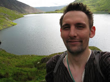
We headed out towards the Brackenthwaite Hows and on through the Lanthwaite Woods. Then from nowhere a red squirrel dashed in front of us onto some cut logs by the path. Trying to get the camera, I could only get blurred shots!! Then after no time at all the squirrel was up in the trees and out of view!!  Moving on, we arrived at the top of Crummock Water, where the was a well placed bench in a parting of the trees, so we decided to have some lunch. The views across the water were lovely, with the high hill of Grasmoor dominating the left side and Melbreak on the right. Both wanting to be climbed! The weather was behaving itself now, although still a little bit blustery we walked around the top of the water past the pump house and up through some fields up into Green/Flas Wood (NY 146 201). Still debating whether or not to climb up a hill we decided to go for it, we walked around the north side of Melbreak.
It was quite an exposed route up (oops), past Raven and White Crag. At some points extremely windy but there were clear views back over Loweswater and beyond. I strolled ahead and waited at the top by the cairn of stones (509m). Helen, Paul and I trying to stay up, without being blown over by the wind!! Time passing we knew that the sunlight hours were falling away so we descended quickly down into Mosedale (Moseley in the  Lakes???). A lonely clump of trees in the middle of the valley caught my eye, as the shadows started to get long. We then went full cycle and headed northwards past an Earthworks and back to the pub at Loweswater. After a pint or two and some food we walked back along the main road, in complete darkness, a good place for ghost and horror stories!! After a few miles we got back to the hotel! ala barn and rustled up a few bottles
  and called it a day.
Woke up, the sound of wind gone, and the sun was out. Excellent. Now I needed to persuade my companions to climb up a large hill before we head off home. After some breakfast, we packed up and decided to head over towards Grasmoor. We began the walk at the car park at Lanthwaite Green Farm, crossed the road and headed towards Gasdale Gill. There were quite a few people out walking today but they walked off towards Whin-Ben which was towering over us on the left. We walked along the beck, scrambling at points. The stream was throwing water down so at some points it was a little tricky.
The path easing out and the full stretch of the Gill came into view. Negotiating some waterfalls the walk climbed up towards the col,  called Coledale Hause. At this point you could see all the way down to Braithwate and Keswick, with the large hills of Skiddaw behind. At this point Paul and Helen wanted to make tracks back, so I decided to carry on and join them back to the car, so our stories diverge at this point. Determined to get to the top, I headed southwards with Crag Hill towering to my left, I cut up a steep slope up to to Grasmoor. The actual summit was a bit further on than what I thought! At a height of 852m the hill
 gives a great panoramic view of the western lake district. I managed to pick out Great Gable and Pillar in the distance!! Also hanging in the air were a couple of Para gliders. They must have had an awesome view. Conscious of the time I began my descent down Lad Howes. This ridge swept down towards Crummuck Water below.
Watching one of the Para gliders crash into some bracken – that  must have hurt – and then take off again.. the path opened up onto the road which I followed back for a mile or so back up to the car park. Glad to see Paul and Helen waiting we began the long journey back home.
Details
Loweswater and Melbreak
Total Ascent: 580m
Total Distance: 15.5 Km
Start and End: NY115 227
Time: 6 hours.
Grasmoor and Gasdale Gil
Total Ascent: 776m
Total Distance: 9.95km
Start and End: NY159 207
Time: 4-5 hours