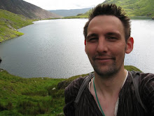
Up early on a Sunday morning, some up earlier than others, we all made our way to the Peak District National Park, and in particular to just off from the Goyt Valley, near the car parks there. Unfortunately many of us running late, some of the walkers thought hey had been left stranded.. :) Anyway as the time approached 11am, we all began to turn up. Walking today were, Helen P, Fran, Scott, Paul, Helen E, Marta, Jon, Antony, Rowena, Laura, Kiri, and their friend Tom (newcomer) and myself. A few sickies and alternative plans came in from a few others. 
The walk did not begin with the best of starts as we were trying to get everyone in the same place, once done, we avoided the initial stroll up Goyt’s Lane, which I’m sure I wouldn’t be popular if I made people walk up that first! We began walking for proper, at the car park at the top of this road (SK02043 75178) and headed eastwards back to the main road from Buxton to Manchester (A5006). We passed a shrine on the left. Omens? At the junction we went through the gate and walked down the track towards Rake End. As we approached the road, the clouds started to empty, not for the first time. So the usual stop and donning on waterproofs we got back onto the main road where we walked a couple of hundred yards and went other a stile and headed up the hill (SK02400 76288). 
This winded eastwards around a contour in the hill through a rather muddy track towards the Whitehall Centre (Outward Bounds). Plodding through the half foot deep muddy water, we spotted that the centre has their own little go ape in the trees! We carried on and walked around the back of the centre and onto the Midshires Way. After initially missing the turn point at (SK03338 76360), I managed to gather the group back and we began crossing the hill towards Broadlee Farm.
After crossing a few fences and fields, I managed to find a minor footpath which would take us up onto the hill. Although to be honest it really didn’t look like much of a path at all. To which I had to convince most of the walkers that it was actually a path and not just some random off road route (SK03560 76598). We walked over through some rocks, and hugged the side of the hill which is the start of Comb’s Edge. Although sidetracked by some interesting looking gullies, we preserved through what looked like Jurassic Park.
We could see our destination for lunch, which was a small old croft sitting on the side of the hill (SK05155 76808). Admiring the views across to the village of Combs and the reservoir beyond it we could see quite a lot people out sailing. As we cleared up and moved away it was clear that the rain wasn’t going to hold away for much longer. We kept up on the edge of the hill by the wall. You could just about hear the rain hitting the trees in the valley a mile or so away. A rainbow became clear in the valley, as we turned north eastward at the old Iron Age fort, long ago reduced to a mound in the hill by the ravages of time.
As we turned it became even more obvious that we were not going to escape the rain. A huge and rather angry gray cloud was suffocating the horizon. We carried 
It had to be said there wasn’t much water in the reservoir more really on our clothes as we walked around the empty hole in the ground! We strolled through the woods and down towards the edge of Buxton. 
With the group reassembled we walked passed the Park at the Hospital back onto the Manchester road. Walking for a mile or so it became clear to me that the weather made the road quite dangerous, so I decided to walk the group up the Midshire’s Way (an old roman road). A bit tired and weary it became clear I had made mistake in thinking there was a footpath further up across the fields to the top of Goyt Lane. Near quite an appropriate named place ‘Round the Bend’, half the group chose to make a dash across the fields as they realised the road was nearer at that point. The rest of us plodded on a mile or so down the track and caught back across. Only later did I find out that one of the party knew the area well and walked their dogs regularly cross the fields.. so some of us walked on further than we had to.. One of the party injured as well, this was not the best.
A breakdown in communication was thankfully not made worse, to the efforts of a few people guaranteeing everyone was alright. We all made it back to the car 
Thanks to everyone who came along. I hope you all enjoyed the walk apart from the weather and the mix up at the end. Please I am only human and if people know an area where I have setup a walk, can they tell me because that kind of feedback is invaluable and helps especially when tiredness sets in. Also please come along next time and invite some people you know who want to stretch their legs!!
Details:
Start and finish location: Car park at top of Goyt Lane (SK02043 75178)
Distance: 21km (shorter by around 2km in you cut across the fields)
Altitude Gain: 446m
Time: 6hr
Walk: Is through undulating hills, fields, woods and moorland.
Group Size: 13